

How the Marsh Developed
This unique environment was shaped first by the sea and then by the actions of man. The Domesday Book records the rich variety of our ancestors’ activities here.
4000 years ago the marsh was a lowland forest. Over some thousands of years, due to crustal subsidence, the land was flooded by the sea. As deposits of sand and shingle were washed in by the sea, an initial protective shingle barrier was formed near to the present shoreline. When further deposits built up, creeks and estuaries were formed where the water drained into the sea. More sand and shingle was washed in which eventually blocked the creeks and estuaries, and alluvial soil washed down from the higher ground accumulated.
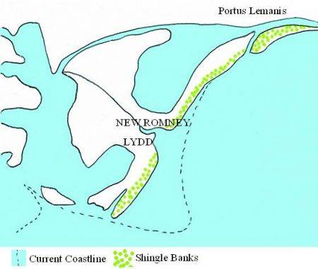
The Marshes in about 400AD
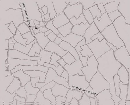
A plan of the dykes and sewers at Newchurch, which have remained almost unchanged over hundreds of years
Thus the layers now forming the land mass of Romney Marsh are of alluvial soil, sand and peat (formed by the decaying early vegetation).
With the building of the sea wall and the draining of the dykes by man, Romney Marsh was created north of the Rhee Wall. Further changes took place during the violent storms of the 13th century.
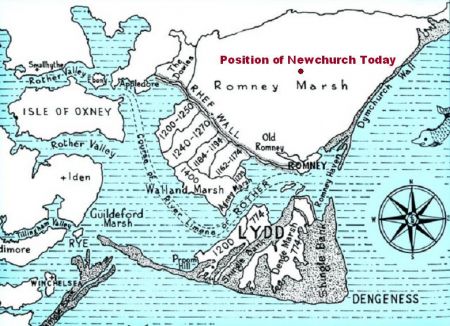
The Marshes show the approximate periods during which the various lands were inned
In the 4th century, a lagoon existed where Newchurch and the surrounding villages are now, but by the late Saxon and Domesday survey times, this area had been reclaimed from the sea and most of the coastal changes were then taking place around Appledore, Rye and Winchelsea.